Climate Change and Health: Air Quality
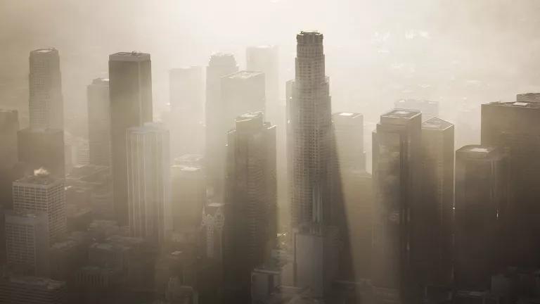
Climate change will increase the number of bad air days across much of the United States.a This puts millions of Americans at risk for irritated eyes, noses, and lungs, but it’s particularly dangerous for young children, older adults, people who work or exercise outside, and our country’s more than 24 million asthma sufferers.b
Explore the map to see which parts of the country are most affected by unhealthy air, or check out your area by clicking on a state, or click on the magnifying glass to type in your address.
Our analysis shows that the health of nearly 127 million Americans is threatened by both smog pollution and ragweed pollen, which can worsen respiratory allergies and asthma. Smog forms when pollution from power plants, vehicles, and other sources reacts to form ground-level ozone, the main ingredient of smog.f Increasing temperatures and sunlight can speed up this process and result in more smog.g Warmer and drier fall weather may also extend the summer smog season into fall in some parts of the country.h
As carbon dioxide levels rise—enhancing the growth of ragweed and other pollen-producing plants—and warm seasons get longer, we will also see higher pollen concentrations being produced over a longer period each year.i
The double whammy of more smog and more pollen contributes to more missed school and work days, more trips to the doctor, higher medical costs, and a rise in the number of premature deaths each year.j But we aren’t doomed to this fate. We can clean up our air and avoid the health threats of climate change by:
- Calling on companies and decision makers at all levels of government to help reduce smog-forming pollution and carbon pollution from power plants, vehicles, and other sources.
- Demanding that our federal, state, and local governments prepare for the health threats of climate change. Today, fewer than one-third of U.S. states have developed a plan to address the health impacts of climate change.
- Learning how to protect ourselves on bad air days.
a. U.S. Global Change Research Program, The Impacts of Climate Change on Human Health in the United States: A Scientific Assessment, chapter 3, “Air Quality Impacts,” 2016 (accessed May 1, 2017).
b. Centers for Disease Control and Prevention, “Most Recent Asthma Data,” https://www.cdc.gov/asthma/most_recent_data.htm, 2017 (accessed May 1, 2017).
c. U.S. Environmental Protection Agency, “Pre-Generated Data Files: Annual Summary Data,” (accessed May 1, 2017).
d. Early Detection & Distribution Mapping System (EDD MapS), “Common Ragweed, Ambrosia artemisiifolia L.,” https://www.eddmaps.org/distribution/uscounty.cfm?sub=5076&map=distribu…, 2017 (accessed May 1, 2017).
e. Asthma and Allergy Foundation of America, “2015 Asthma Capitals,” https://aafa.org/asthma-allergy-research/our-research/asthma-capitals/, 2015 (accessed May 1, 2017).
f. U.S. Global Change Research Program, The Impacts of Climate Change, chapter 3.
g. Ibid.
h. Zhang, Y., and Wang, Y., “Climate-Driven Ground-Level Ozone Extreme in the Fall Over the Southeast United States,” Proceedings of the National Academy of Sciences 113, no. 36 (2016), https://www.pnas.org/doi/abs/10.1073/pnas.1602563113 (accessed May 1, 2017).
i. U.S. Global Change Research Program, The Impacts of Climate Change, chapter 3.
j. Ibid.
Climate Change and Health: Air Quality FAQs
The interactive map explores how climate change threatens our health in a fundamental way—through the air we breathe. Analyzing data from counties across the country, we found that nearly 127 million Americans—four out of every 10 people—live in counties with both pollen-producing ragweed and smog pollution. This double whammy of unhealthy air quality can worsen respiratory allergies, cause heart problems, and lead to premature deaths1—particularly for the more than 24 million Americans with asthma.2
By entering your address or clicking on a state, you can explore how climate change is impacting air pollution and public health in your area. We also explain how local solutions can make the air safer and what—if anything—state governments are doing to address the health impacts of climate change-fueled dirtier air, in the absence of leadership at the national level.
Climate change is one of the most serious global health threats we face, with the World Health Organization warning that about 250,000 additional deaths will be caused by climate change each year between 2030 and 2050.3 As climate-changing pollution from fossil fuels drive up global temperatures, the threat of a wide range of serious health risks also increases—from asthma and heat-related illnesses to infectious diseases like Lyme and Zika.
Climate change aggravates smog, comprised mostly of ozone, which is the result of pollution from power plants, vehicles, and other sources reacting in the presence of sunlight and heat.4 Rising temperatures can speed up this process and increase smog levels; and longer warm periods can extend the summer smog season.
Ragweed may not be the most widely recognized source of allergenic pollen, but it’s among the most serious. More people are reportedly allergic to ragweed than all other pollens combined.5 The late summer and early autumn season for ragweed pollen production is now almost a month longer in many parts of the U.S. than it was 20 years ago, and that trend stands to continue.6 As warm seasons lengthen and carbon dioxide levels rise—enhancing the growth of ragweed and other pollen-producing plants—we are likely to see more of this allergenic pollen being produced over a longer period each year.7 The season from late summer into fall poses a big double-whammy to respiratory health, since that’s the season when both smog and ragweed pollen levels are often at their highest.
The map has several layers, which help illustrate the combined impact of smog and ragweed pollen on air quality. We created the smog layer using publicly available data from the U.S. Environmental Protection Agency’s (EPA) AirData website.8 The datasets included a field calculated by EPA representing the number of days per year when an eight-hour average concentration of ozone exceeded the 2015 Ozone National Ambient Air Quality Standards (0.070 parts per million).9 We averaged data by U.S. county to determine the annual average number of ozone exceedance days per county per year across the 2011 to 2015 period. Multiple monitors at a single site were averaged, and only monitors with at least 75 percent data completeness in each of the five years we considered (2011-2015) were included.
For the ragweed layer, we used the Early Detection and Distribution Mapping System (EDDMapS)10 to assess whether U.S. counties had confirmed reports of the presence of common ragweed (Ambrosia artemisiifolia) as of 2016.
To show where smog and ragweed overlap, we created a layer of counties having both: (1) one or more unhealthy ground-level ozone days, on average, per year from 2011 to 2015; and (2) the reported presence of common ragweed (Ambrosia artemisiifolia) as of 2016. Estimates of populations potentially affected by these conditions were taken from the 2015 Census.11
Finally, we added a layer showing where regions found in our analysis to have these air quality issues coincide with the ranking of Asthma Capitals compiled by the Asthma and Allergy Foundation of America (AAFA) in 2015.12 AAFA ranks the largest U.S. metro areas by looking at multiple factors, including how common asthma is, environmental conditions (including annual pollen measurements and length of peak pollen season), and health care use. NRDC’s analysis shows that in 2015, of the top 50 Asthma Capitals, 34 are in counties with both unhealthy ground-level ozone smog levels and reported ragweed presence.
NRDC’s analysis created a map showing those counties in the 50 states having both: (1) an average of one or more unhealthy ground-level ozone days per year from 2011–2015; and (2) the reported presence of common ragweed (Ambrosia artemisiifolia) as of 2016. The numbers of people living in counties affected by these conditions were based on county population estimates from the 2015 U.S. Census.13
On the state pages, we ranked states based on the percentage of residents living in counties reported to have both an average of one or more unhealthy ground-level ozone days per year and the reported presence of ragweed, with population estimates taken from the 2015 Census. For states with only ozone or ragweed, we showed the corresponding percentage of residents living in affected counties and did not do a ranking.
That means something slightly different for each layer of the map. For the ragweed layer, it indicates “no data.” For the ozone layer, it indicates, “no data/insufficient data.”
The source of the ragweed data14 reports simply the presence or absence of ragweed (Ambrosia artemisiifolia) in a county, by collecting reports submitted by registered users to an interactive Web interface. Once reported to the web system, the data are “reviewed by state verifiers to ensure all data is accurate.” The data are made freely available to the public. The apparent absence of ragweed in a given county may mean one of three things: (1) the plant is actually absent; (2) the plant is present, but has not been detected by observers; or (3) observations of the plant have not yet been reported into the system or reviewed.
The source of the ozone data15 provided annual summary data for ground-level ozone concentrations from 2011 through 2015, from an EPA-calculated field representing the number of days per year when monitored eight-hour average concentrations of ozone exceeded the 2015 Ozone National Ambient Air Quality Standards (0.070 parts per million).16 We averaged data from the 2011-2015 period at each monitor to determine the average number of ozone exceedance days annually. To get to the county value that was then mapped, we averaged data from monitors within that county to calculate each county’s average number of ozone exceedance days annually. We applied “completeness criteria” for this calculation by only including monitors with at least 75 percent of their data complete for each of the five years included. Counties with a single monitor were assigned that monitor’s average number of ozone exceedance days per year. For counties with multiple monitors, the county was assigned a mean of the monitor-level means. Therefore, grey on the map could signify either that there were no available monitors within that county (no data); or insufficiently complete data coming from available monitors within the county (insufficient data).
Counties shown in white on the ozone map signify less than one annual ozone exceedance day, on average, from 2011 to 2015. Thus, a white area on the map does not indicate that air quality was always at healthy levels over the period, but that ozone exceedance days were sufficiently rare to result in a low average.
Our method included the total area of a county as exceeding the eight-hour ozone standard if monitors within the county register exceedances. This can potentially overstate ozone concentrations, especially in large counties like those in the U.S. West, and does not take into account potential bias due to differences in urban versus rural land use or land cover in the areas surrounding the monitors. Assessing air pollution at a finer scale would require air pollution modeling that is beyond the scope of the present project.
All this points to the value of establishing networks of more monitoring sites, to gather more geographically widespread, daily, active monitoring of environmental conditions that can affect public health -- like ragweed, which produces allergenic pollen; and ozone smog, which individually or together can threaten respiratory health for millions of Americans.
To reduce air pollution and build a better future for our children, we must fight climate change by addressing the root cause: heat-trapping pollution from fossil fuels. At the global level, countries—including the United States—should follow through on their international commitments to shift away from fossil fuels toward cleaner, smarter energy options. Another direct benefit of reducing fossil fuel use is that it reduces the health-harming air pollutants it produces, including fine particles, chemicals that combine to form ozone smog, and air toxics.
Here at home, America needs to fully implement existing climate policies like the Clean Power Plan, which established the first national limits on carbon pollution from power plants, and greenhouse gas limits for cars and trucks. To fully protect our health, companies and decision-makers at all levels of government should also go beyond existing policies to make deep cuts in the pollution warming our climate.
Finally, governments at all levels—federal, state, and local—must prepare for the health threats of climate change. Fewer than one-third of states have developed a plan to address the health impacts of our changing climate.
1. U.S. Global Change Research Program, The Impacts of Climate Change on Human Health in the United States: A Scientific Assessment, chapter 3, “Air Quality Impacts,” (accessed May 1, 2017).
2. Centers for Disease Control and Prevention, “Most Recent Asthma Data,” https://www.cdc.gov/asthma/most_recent_data.htm, 2017 (accessed May 1, 2017).
3. World Health Organization, “Climate Change and Health,” http://www.who.int/mediacentre/factsheets/fs266/en/, 2016 (accessed May 1, 2017).
4. U.S. Global Change Research Program, The Impacts of Climate Change, chapter 3.
5. Wodehouse RP, Hayfever Plants (1971), Hafner, New York, 2nd ed.; Ziska L, et al., “Recent Warming By Latitude Associated With Increased Length of Ragweed Pollen Season in Central North America,” Proceedings of the National Academy of Sciences 108, no. 10 (2011). http://www.pnas.org/content/108/10/4248.abstract (accessed May 1, 2017);
6. Ziska L, et al., “Recent Warming By Latitude Associated With Increased Length of Ragweed Pollen Season in Central North America,” Proceedings of the National Academy of Sciences 108, no. 10 (2011), http://www.pnas.org/content/108/10/4248.abstract (accessed May 1, 2017).
7. U.S. Global Change Research Program, The Impacts of Climate Change, chapter 3.
8. U.S. Environmental Protection Agency, “Pre-Generated Data Files: Annual Summary Data,” (accessed May 1, 2017).
9. U.S. Environmental Protection Agency, “2015 Ozone National Ambient Air Quality Standards (NAAQS) Nonattainment Actions,” https://www.epa.gov/ozone-pollution/2015-national-ambient-air-quality-s… (accessed May 1, 2017).
10. Early Detection & Distribution Mapping System (EDD MapS), “Common Ragweed, Ambrosia artemisiifolia L.,” https://www.eddmaps.org/distribution/uscounty.cfm?sub=5076&map=distribu…, 2017 (accessed May 1, 2017).
11. U.S. Census Bureau, “2011-2015 American Community Survey 5-Year Estimates,” factfinder.census.gov, 2015, (accessed June 5, 2017).
12. Asthma and Allergy Foundation of America, “2015 Asthma Capitals,” http://www.aafa.org/page/asthma-capitals.aspx, 2015 (accessed May 1, 2017).
13. U.S. Census Bureau, “2011-2015 American Community Survey 5-Year Estimates,” factfinder.census.gov, 2015, (accessed June 5, 2017).
14. Early Detection & Distribution Mapping System (EDD MapS), “Common Ragweed, Ambrosia artemisiifolia L.,” https://www.eddmaps.org/distribution/uscounty.cfm?sub=5076&map=distribu…, 2017 (accessed May 1, 2017).
15. U.S. Environmental Protection Agency, “Pre-Generated Data Files: Annual Summary Data,” accessed May 1, 2017).
16. U.S. Environmental Protection Agency, “2015 Ozone National Ambient Air Quality Standards (NAAQS) Nonattainment Actions,” https://www.epa.gov/ozone-pollution/2015-national-ambient-air-quality-s… (accessed May 1, 2017).
Find out how we did the map and analysis
Ozone Data and Maps
We created the ozone map with publicly available data from the U.S. Environmental Protection Agency's (EPA) AirData Website.1 We downloaded annual summary data for ground-level ozone concentrations from 2011 through 2015. The data sets included a field calculated by the EPA representing the number of days per year when an eight-hour average concentration of ozone exceeded the 2015 Ozone National Ambient Air Quality Standards (0.070 parts per million).2 For each U.S. county, we averaged data from the 2011–2015 period to determine the average number of ozone exceedance days annually at the county level. Multiple monitors at a single site were averaged, and only monitors with at least 75 percent data completeness in each of the five years were included. Counties with a single monitor were assigned that monitor’s average number of ozone exceedance days per year. For counties with multiple monitors, the county was assigned a mean of the monitor-level means.
Ragweed Data and Maps
We used the Early Detection and Distribution Mapping System (EDDMapS)3 from the Center for Invasive Species and Ecosystem Health at the University of Georgia to assess whether U.S. counties had confirmed reports of the presence of common ragweed (Ambrosia artemisifolia)
Counties with Both Ozone Exceedance Days and Ragweed
NRDC's analysis subsequently created a map showing those counties in the 50 states having both: (1) an average of one or more unhealthy ground-level ozone days per year from 2011-2015; and (2) the reported presence of common ragweed (Ambrosia artemisiifolia) as of 2016. Estimates of populations potentially affected by these conditions were taken from the 2015 Census.4
State Rankings
On state pages, we ranked the states based on the percentage of residents living in counties reported to have both an average of one or more unhealthy ground-level ozone days per year and the reported presence of ragweed, with population estimates taken from the 2015 Census. For states with only ozone or ragweed, we showed the corresponding percentage of residents living in affected counties and did not do a ranking.
"Asthma Capital" Cities
The Asthma Capitals report5 is a yearly research project of the Asthma and Allergy Foundation of America (AAFA),6 a nonprofit organization dedicated to helping patients with asthma and allergies. AAFA ranks the 100 largest U.S. metro areas by looking at multiple factors, including how common asthma is, environmental conditions (including annual pollen measurements and length of peak pollen season), and health care use. Cities are ranked from highest total score to lowest total score, with rank #1 indicating the most challenging city to live in with asthma.
We overlaid the top 50 Asthma Capitals from 20157 on the NRDC map layer showing both an average of one or more unhealthy ground-level ozone days per year and the reported presence of ragweed. NRDC's analysis shows that of these top 50 Asthma Capitals, 34 occurred in counties with both unhealthy ground-level ozone smog levels and reported ragweed presence.
Citations
1. U.S. Environmental Protection Agency, “Pre-Generated Data Files: Annual Summary Data,” (accessed May 1, 2017).
2. U.S. Environmental Protection Agency, “2015 Ozone National Ambient Air Quality Standards (NAAQS) Nonattainment Actions,” https://www.epa.gov/ozone-pollution/2015-national-ambient-air-quality-s… (accessed May 1, 2017).
3. Early Detection & Distribution Mapping System (EDD MapS), “Common Ragweed, Ambrosia artemisiifolia L.,” https://www.eddmaps.org/distribution/uscounty.cfm?sub=5076&map=distribu…, 2017 (accessed May 1, 2017).
4. U.S. Census Bureau, “2011-2015 American Community Survey 5-Year Estimates,” factfinder.census.gov, 2015, (accessed June 5, 2017).
5. Asthma and Allergy Foundation of America, “2015 Asthma Capitals,” http://www.aafa.org/page/asthma-capitals.aspx, 2015 (accessed May 1, 2017).
6. Asthma and Allergy Foundation of America, “About AAFA,” https://aafa.org/about-aafa/ (accessed May 1, 2017).
7. Asthma and Allergy Foundation of America, “2015 Asthma Capitals.”
Credits
Project teams: NRDC Science Center, Communications Department, Climate & Clean Air program
Researchers and writers (alphabetical order): Tom Barkley, Juanita Constible, Kim Knowlton, Alex Krefetz, Jillian Mackenzie, Lauren Reiser, Christina Swanson
Reviewers (alphabetical order): Sean Alcorn, Juan Declet-Barreto, Ariana Gonzalez, Aliya Haq, Karen Hobbs, Alex Jackson, Patrick Kinney, Noah Long, Nick Magrisso, Katharine McCormick, Jackson Morris, Miriam Rotkin-Ellman, Christina Swanson, John Walke, Samantha Williams
Editor: Sarah Engler
Data analysis and map production (alphabetical order): Alex Hart, Kate McKenney, ZevRoss Spatial Analysis
Related Resources

Political Control of Research Funding Threatens Sound Science

The Carbon Removal Market Can Work—If We Build It Right
