

As reported a few weeks ago in a previous post, NRDC has been fighting a proposal by the Interior Department that would greatly expand oil and gas drilling within Utah’s Desolation Canyon wilderness area. Known as the "Gasco" plan by the drilling company who would benefit from this plan, incredulously, the administration’s preferred alternative expands the amount of wilderness lands that would be drilled beyond even what Gasco originally proposed. In fact, the Interior Department has nominated that drilling would occur on 9,466 acres of wilderness lands. This excursion into wilderness makes little sense since the overall drilling plan already provides nearly 200,000 acres of additional non-wilderness lands in the region for oil and gas production.
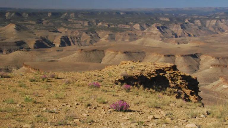
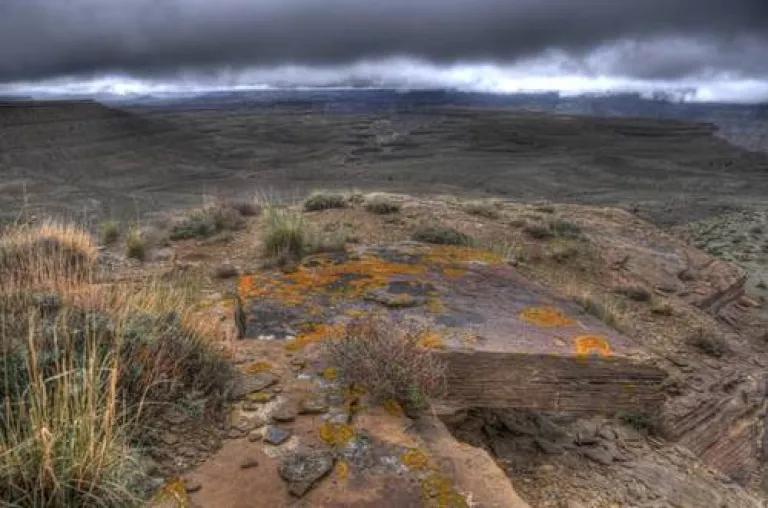
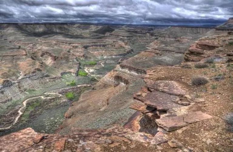
While I could try and describe how remarkable the Desolation Canyon area is, the following photos do a far better job in demonstrating what is at stake. These pictures, taking recently by the Southern Utah Wilderness Alliance, detail the area around the Desolation Canyon wilderness that would face decimation if the Interior Department decides to approve the agency’s preferred drilling plan.
But it is not too late to protest the plan. The Interior Department is still taking comments on whether to approve drilling in this wilderness area. And we know from past experience that public input does make a difference.
Please send a message today before the drill rigs descend on this untouched wilderness in Utah’s Redrock country.
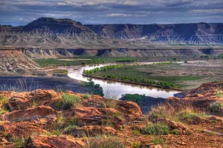
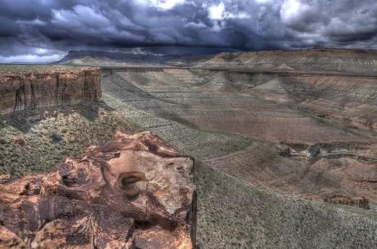
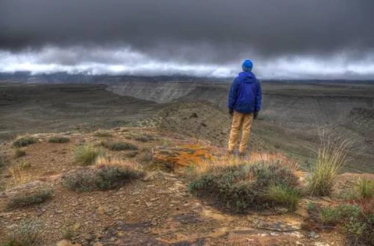
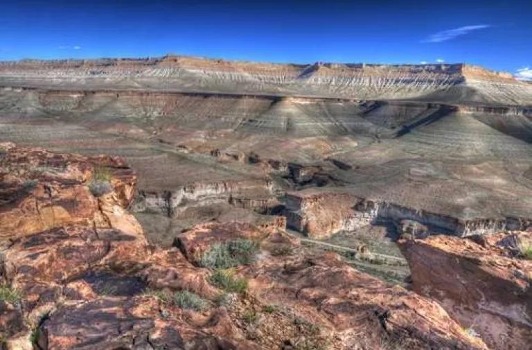
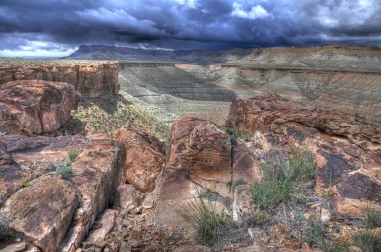
What is now a wilderness experience for recreational floaters and hikers alike, would be altered forever, marred by the sights and sounds of drilling rigs along the rim of Desolation Canyon.
Photo credits: Southern Utah Wilderness Alliance