A Decade on the California Delta
Photographer Max Whittaker shows us the many faces of the delta, including its strange and fascinating history and the challenges complicating its future.
All photographs by Max Whittaker
More than 1,100 miles of waterways snake through the heart of Northern California, connecting the Sacramento and San Joaquin Rivers to the San Francisco Bay between the cities of Sacramento and Stockton. This is the California Delta, commonly known as the San Francisco Bay–Delta, a vast estuary that is an oasis for wildlife, an important agricultural center, an economic resource, and a favorite recreation spot for millions of Californians.
But the delta is at risk, threatened by unsustainable water diversions, rising sea levels, pollution, residential development, and a warming climate. What’s more, it has been at the center of California’s fight over water resources for years. In many years, farms and cities divert more than half of the water that would have flowed in these rivers and into the Delta, harming fish and wildlife. Recently, the State Water Resources Control Board announced proposals to require reduced water diversions in order to ensure greater amounts of fresh water can flow into and through the Bay-Delta, in order to help restore this fragile ecosystem.
Photojournalist Max Whittaker has been taking pictures of the delta and its inhabitants for nearly 10 years. His images convey the region’s rich history and spectacular beauty and reveal a passion for this one-of-a-kind estuary that is nearly palpable.
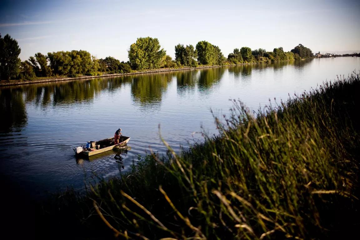
Tall grasses blow along the edge of the river near Isleton.
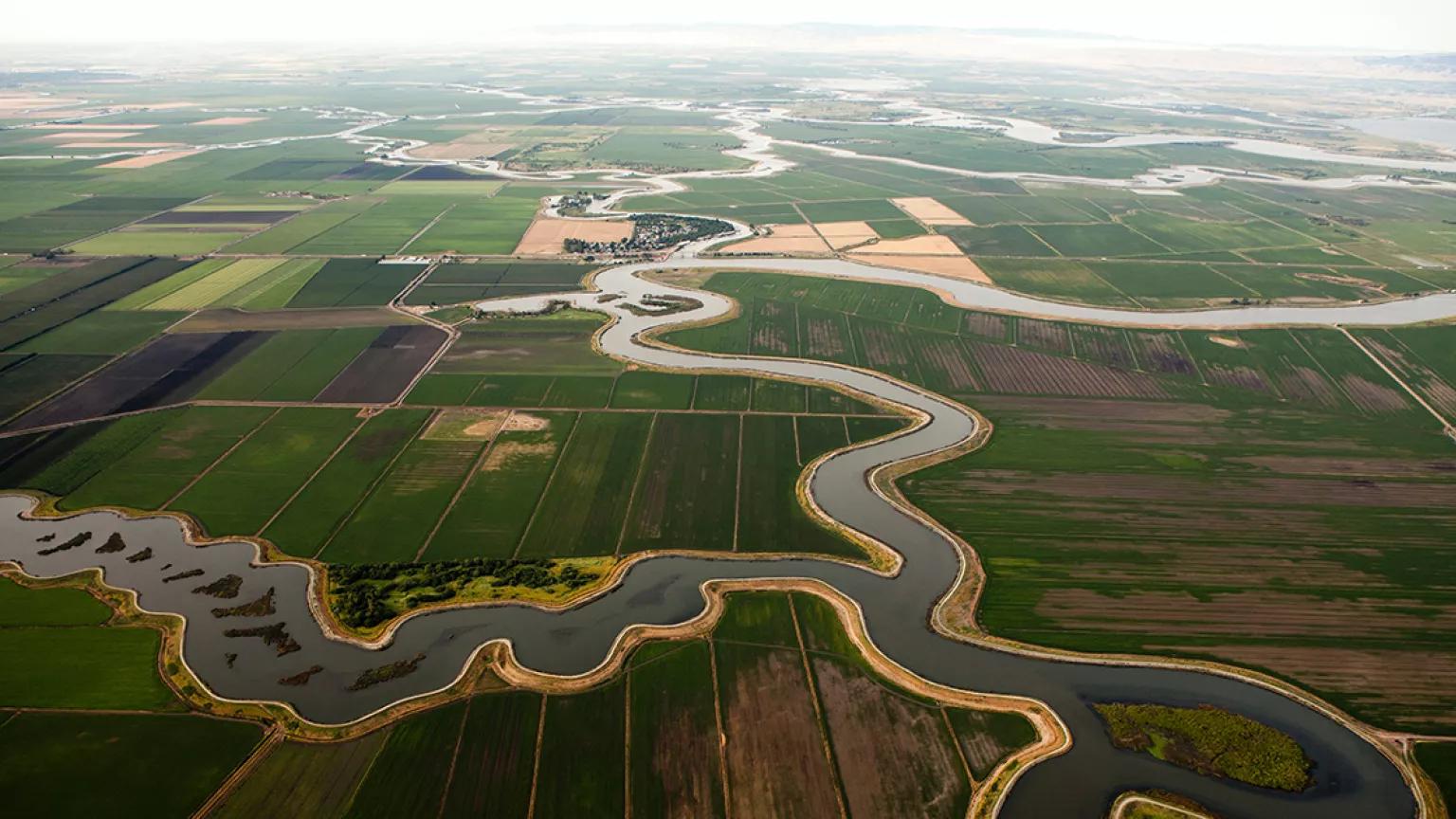
A Landscape Long Under Pressure
The delta’s waterways are a brackish mix of mostly fresh water and some salt water from the Pacific Ocean. Plans have been in the works for years to build a massive new water diversion facility and tunnels under the Delta (the environmentally destructive California WaterFix project) and to increase water diversions, reducing freshwater flows into and through the estuary. Even though water exports from the Delta by the state and federal water projects only account for approximately 8 percent of the state’s total water supply, nearly two thirds of the state’s population and one third of California’s irrigated farmland rely in part on water from the Bay-Delta.
The delta sits largely below sea level, and the lands and islands that border the rivers are protected by a system of levees (shown top right, below). The levees were built in the mid-1800s, mostly by Chinese laborers who helped cultivate the region. Before this, the area where the delta now sits was mostly tidal marsh. Age has taken a toll. In 2004, a 350-foot section of a levee collapsed, flooding more than 5,000 acres of crops and homes in the Upper Jones Tract. This sounded an alarm, prompting state and local agencies to spend tens of millions of dollars maintaining and upgrading levees in the Delta.

In early 2017, after weeks of heavy rains in Northern California, levee workers intentionally breached a section along the Mokelumne River. This flooded the McCormack-Williamson Tract, an island of farmland near Walnut Grove (shown bottom left, below) that has been owned by the Nature Conservancy since 1999. The organization has sought to restore the area’s tidal freshwater marsh and floodplain habitat.
Farming the Delta
A majority of land in the delta is dedicated to farming, and agriculture is the economic engine of the region. Crops such as rice, grapes, berries, pears, and almonds are grown year-round, providing jobs to thousands of local and seasonal workers.
Climate and soil in the delta make it one of the most productive growing regions in the state. However, the tilling of the peat-rich soil is a major source of carbon emissions. State and local agencies, in partnership with a coalition of environmental groups and other stakeholders, are working to restore portions of its wetland ecosystem as a critical tool in the fight against climate change.
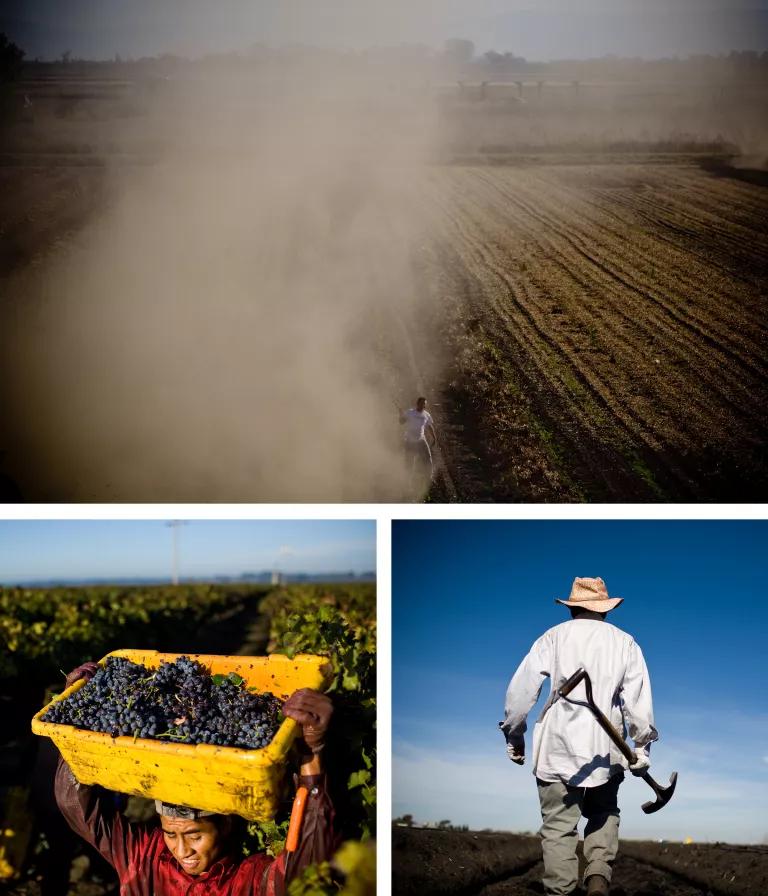
Farmers in the Delta have easy access to water from nearby irrigation pumps, but there remain disputes over water rights in the Delta, as there are in many parts of California. A 2014 study concluded that California has issued water rights for five times more water than exists in a normal year in California.

During the middle part of the last century, workers constructed the federal Central Valley Project and State Water Project, which continue to divert water to the Central Valley and Southern California through a system of dams, canals, and massive pumping stations in the Delta (shown above). Increased water diversions has resulted in a precipitous decline of salmon and other native fish and wildlife in the estuary. Farms throughout California account for nearly 80 percent of the human uses of water. Unsustainable water diversions, water pollution, and poor management has hampered proper stewardship of this most precious resource.
A Place to Unwind
More than 10 million people live near the delta, and residents and tourists alike flock to the area for recreational activities. Boating is a favorite pastime, with dozens of boat launches and rental outfits located in the area.
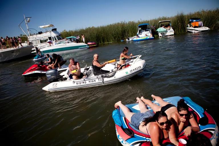
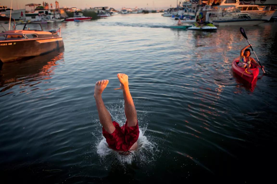
Fourth of July revelers party near Mandeville Tip in 2011.
Wildlife, Native and Not
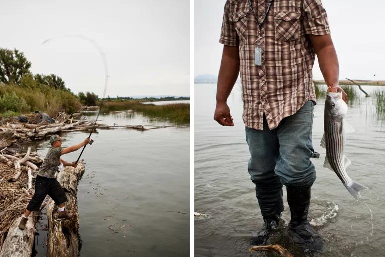
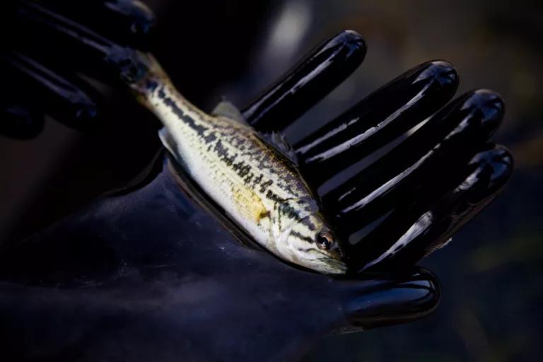
The waterways are home to more than 20 species of fish including Chinook salmon, steelhead trout, and American sturgeon; this bounty sustains thousands of fishing jobs. Another resident fish is the tiny delta smelt. Scientists consider the smelt one of the best indicators of the ecosystem’s overall health—and it hovers dangerously close to extinction.
The delta also harbors some 185 invasive species, which disrupt the natural ecosystems and have the potential to destroy native wildlife and plants.
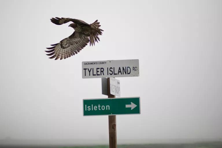
As many as 200 species of birds make their home in the delta, including hawks (below, a Swainson’s hawk), cranes, owls, and the endangered California least tern. According to Audubon California, there are at least 22 bird species from the Bay–Delta listed as endangered, threatened, or of concern.
Migratory bird sightings are at their peak during the winter months, when the bird population swells into the tens of millions. The landscape provides important protections for nesting and breeding.
People Pressure
New development in the delta adds further pressure to the fragile ecosystem. But despite concerns about the strength of the levee systems and rising sea levels, the region’s natural beauty and serenity continue to draw people to the area.
The vast watershed of the delta covers about 75,000 square miles, draining mountains and rivers that reach from eastern Oregon to the southern San Joaquin Valley. Population growth in and upstream of the delta has led to an increase in pollution of the waterways. According to the U.S. Environmental Protection Agency, the watershed exceeds standards for pesticides, invasive species, metals such as mercury, and other toxic substances. High levels of bacteria due to sewage spills and crumbling sewage infrastructure have also been detected.
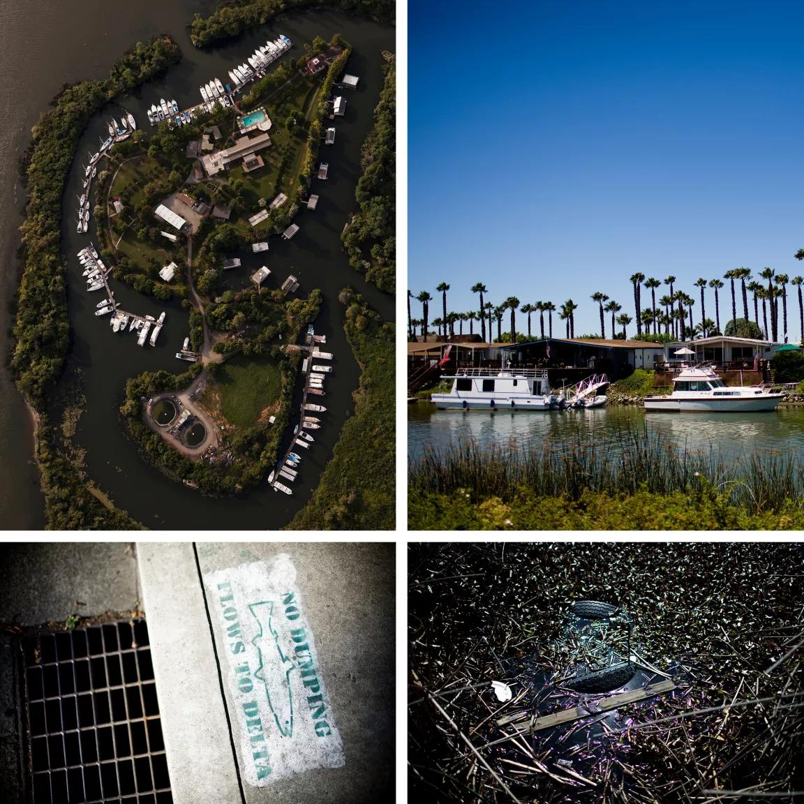
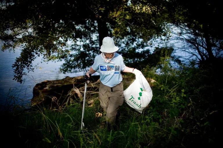
Debris remains a serious problem in the delta. Much of it flows to the region from the rivers and streams that feed it.
The annual Coastal Cleanup Day—this year on September 15—is a massive state-wide volunteer effort. Over the course of three hours in 2017, more than 66,000 volunteers removed 800,000 pounds of trash and recyclables from California’s coastal and inland waterways.
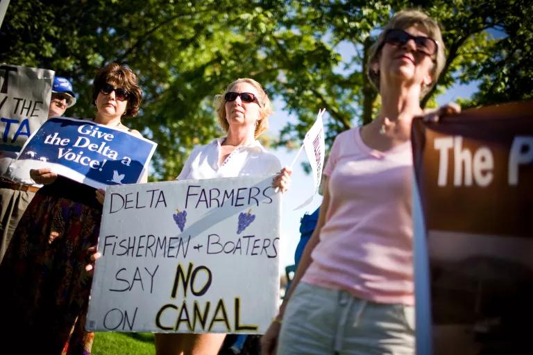
The Future of the Delta
Delta farmers, fishermen, Native American communities, and conservation groups have worked for decades to sustain and restore the Bay–Delta estuary and its incredible fisheries, wildlife, and natural heritage. As the Trump administration seeks to roll back environmental protections for the watershed and its endangered species, the State Water Board is considering new, more protective water quality standards to better protect it and limit water diversions. While scientists and conservation groups consider the State Water Board’s proposals inadequate to resuscitate the Bay–Delta, they are a step in the right direction. It is now state policy to reduce reliance on water supplies from the Delta, and cities like Los Angeles and San Diego are planning to import significantly less of its water, showing that we can sustain the economy while restoring the Bay–Delta estuary. While the state debates next steps, the future of this ecosystem hangs in the balance.
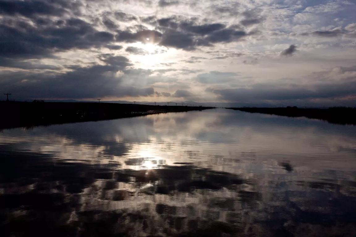
Sun sets over the delta near Discovery Bay.
California, Here Dry Come!
The Dakota Access Pipeline: What You Need to Know
What the Latest SCOTUS Decisions Mean for Our Climate