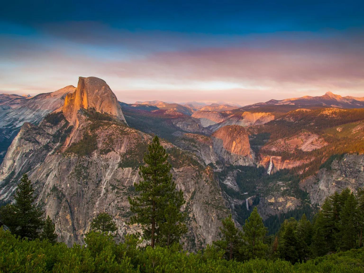
America’s Troubled Waters
From prairie potholes to transboundary rivers, the country’s waterways are suffering from a slew of policies that make it easier to pollute.

In the wake of the 2023 Sackett v. Environmental Protection Agency (EPA) U.S. Supreme Court decision weakening waterway protections, threats have only intensified. Under the second Trump administration, federal lawmakers have advanced policies allowing more contaminants to enter drinking water sources, more oil and gas pipelines to crisscross our streams and rivers, and more wetland draining.
Particularly at risk, wetlands cover just over 5 percent of the contiguous United States but play an important and often overlooked role in our environment. They provide habitat for about half of the country’s threatened and endangered species, take up and filter stormwater, recharge aquifers (the underground source for nearly half the nation’s drinking water), and absorb 10 times more carbon than tropical forests.
And a recent proposal from the EPA could narrow protections for federal waters further, stripping federal protections from at least 86 percent of freshwater wetlands. “This proposal declares open season on the nation’s waterways,” says NRDC's Jon Devine, director of freshwater ecosystems. More than three quarters of our streams would also lose protection, with the West hit hardest. NRDC experts believe the new rule is even worse than the broadly unpopular one the Trump administration proposed last November.
Congress has also taken aim at clean water. Passed in the House in December 2025, the PERMIT Act (HR 3898) purports to help farmers, industry, and developers by removing some permitting requirements for discharging pollutants, weakening numerous other safeguards, and excluding more types of waterbodies from the Clean Water Act. The bill would also weaken checks on pollution that accumulates downstream and limit the EPA’s ability to ensure companies are keeping up with the latest in water treatment technology.
The PERMIT Act’s acronym breaks down to “Promoting Efficient Review for Modern Infrastructure Today,” but the legislation fails to consider our reliance on natural infrastructure, putting the health of communities and entire ecosystems at risk. Here’s a look at how weakening water protections are already troubling three landscapes—from the ridges of Appalachia and the grasslands of the Midwest to the rivers that cross the U.S.–Mexico border.
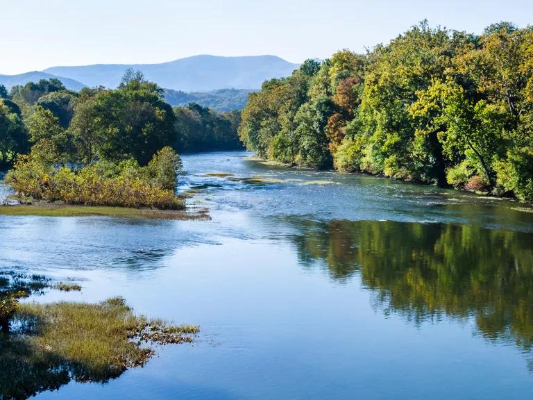
The Greenbrier River in southeastern West Virginia, which flows through the Appalachian Mountains from Durbin to its confluence with the New River at Hinton
Birthplace of rivers: The Appalachian headwaters
Formed nearly half a billion years ago, the Appalachian Mountain headwaters feed the water systems that supply drinking water to tens of millions across the eastern United States. “Those streams function like capillaries in a blood vessel system,” says Mike Becher, an attorney with Appalachian Mountain Advocates. “They contribute essential functions to the rest of the watershed.”
Until recently, permitting requirements under the Clean Water Act protected many of these small and intermittently flowing streams and their surrounding wetlands from pollution discharges. But finalizing the PERMIT Act or the EPA’s proposed rule would undo that safety net.
A legacy of pollution
For much of the region’s industrial history, waterways were treated as expendable. Until 1977, mining companies were allowed to pollute at will. This left lasting harm, including hundreds of abandoned mines that leaked toxic orange sludge into West Virginian rivers.
Today, this legacy pollution mixes with the ongoing contamination that runs off active industrial sites and agricultural fields. These contaminants spread throughout the landscape, especially during storms when rainwater washes over worksites, roads, bare soils, and mine wastes.
“Exposing dirt and rock that’s been buried for millions of years creates salty water that impacts aquatic communities downstream and is laden with chemicals,” Becher explains.
The Clean Water Act has always struggled to control nonpoint pollution (that is, pollution that occurs from widespread, diffused sources). But streams and wetlands can naturally filter that pollution, which is one reason such waters have long been protected under the law.
Both the PERMIT Act and the Trump EPA rule would remove important safeguards for these waters, further endangering an ecosystem in recovery.
Compounding threats
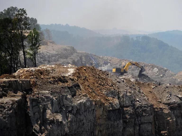
Mountaintop removal—a process that blasts away mountaintops to reach stores of coal below—has buried more than 2,000 miles of Appalachian streams, permanently altering the region’s hydrology and eliminating natural filtration systems. In their place, compacted soil accelerates runoff and carries sediment, salts, and heavy metals downstream.
These pollutants flow together with pesticides washing off fields and contaminants leaked or dumped by industry, including PFAS, the “forever chemicals” linked to cancer and other health risks. The U.S. Geological Survey has found elevated PFAS levels in local groundwater and streams.
Climate change stands to intensify these contamination problems by altering precipitation levels. Researchers project heavier rainfall in the northwestern part of West Virginia and worsening droughts in the southeast. Flooding increases runoff from lands with unhealthy soil, while dry periods can concentrate pollutants as water supplies shrink. Making matters worse, aging water infrastructure already struggles to keep up, especially in rural and low-income communities without the resources to upgrade treatment systems or secure alternative drinking water.
Many locals already feel the impacts of weaker pollution rules, from discolored and foul-smelling well water to depleted fisheries and soiled recreation areas.
In the “Duck Factory”: The Prairie Pothole Region
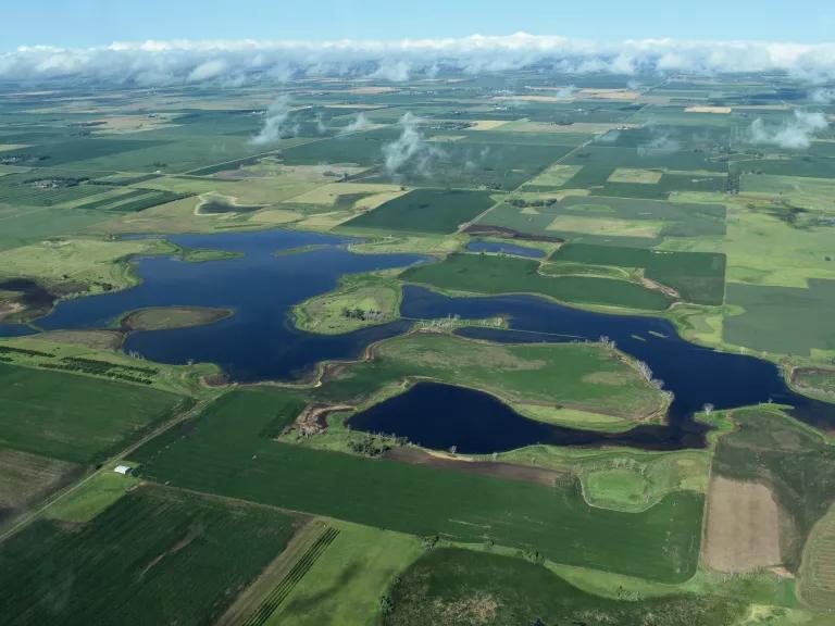
When glaciers retreated about 11,000 years ago, melting ice left millions of shallow depressions across the northern Great Plains. These basins now form a network of wetlands called the Prairie Pothole Region.
This polka-dotted landscape is a haven for waterbirds. In fact, more than half of the continent’s migratory waterfowl depend on these wetlands, earning the region its nickname of “Duck Factory.” But habitat is scarce: Since 1900, more than half of the region’s potholes—across parts of Iowa, Minnesota, Montana, North Dakota, and South Dakota—have been lost, largely due to human activity.
Compounding threats
Indeed, agriculture has reshaped much of the region. Underground drainage systems divert water away from potholes, drying them out. Runoff carries pesticides, fertilizers, and other chemicals into the wetlands that then remain, disrupting the ecosystem and harming insect and amphibian populations. And unrestricted livestock grazing can also degrade and fragment the landscape.
Meanwhile, oil and gas pipelines are expanding across the region, thanks to a combination of policy changes and executive orders that fast-track projects, limit state and Tribal regulatory authority, and allow companies to bypass or delay safety compliance. Such rapid pipeline expansion increases the risks for spills and contamination. Until recently, federal wetland protections helped buffer these threats.
Unfortunately, the Supreme Court’s Sackett decision three years ago narrowed the definition of protected waters under the Clean Water Act. Because most prairie potholes only connect with other waterbodies underground, they no longer qualify. That means fewer hurdles to filling, draining, or polluting these vital wetlands.

What’s at stake
Regional watering holes have already been disappearing. A 2025 federal report showed that seasonal “May ponds,” which are critical breeding habitat for waterfowl, have decreased by 20 percent relative to the long-term average. Nesting waterbirds depend on these wetlands for raising young, but shrinking scraps of habitat mean their chicks are more easily found by skunks, racoons, and other predators. While many of these bird populations still number in the millions, some species, like snow geese and tundra swans, are experiencing ongoing declines.
Beyond the impacts to wildlife, wetland loss ripples throughout the Great Plains, reducing stormwater filtration and increasing flooding. During droughts—parts of the region, in fact, are in the grips of one right now—the lack of wetlands also intensifies topsoil erosion. Fewer potholes to store water also decreases what’s available for rural wells, a threat to communities across the Great Plains.
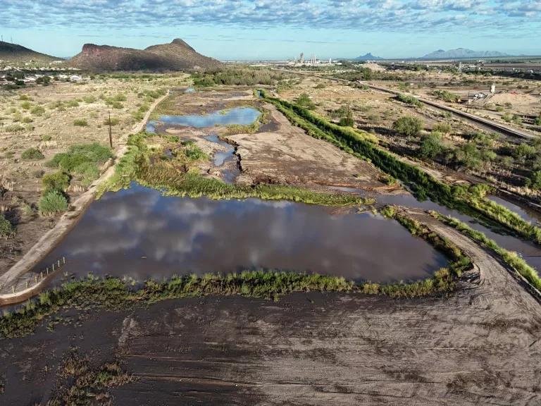
The inner channel of the Santa Cruz River
Seen and unseen: The Santa Cruz River
Rainfall gathers in the oblong basin of Arizona’s San Rafael Valley, flows south into Mexico, and threads through row-cropped fields, ranches, and small towns with baseball diamonds. Gravity curves the Santa Cruz River around the Patagonia Mountains until it turns north and crosses back into the United States between the Sonoran city of Nogales and the Arizona city by the same name.
Here, it encounters the first of three wastewater treatment plants.
A project with impact
In 2009, the EPA spent $66 million upgrading the Nogales International Wastewater Treatment Plant. The result: certifiably clean water feeding the once-depleted Santa Cruz system. “The U.S. is effectively relieving Mexico of a significant wastewater burden,” says Luke Cole, director of the Sonoran Institute’s Santa Cruz River program. “And we have the technology to turn that into miles of flowing river. That’s incredible.”
The project’s success spurred another $600 million in public investment to build more plants, which returned perennial, healthy water flow to Tucson for the first time since the 1940s. The river is now beginning to recharge the 12,000-year-old aquifer, reversing decades of decline in a region long defined by water scarcity.
“This river has a lot of value. It took a lot to get it to where it is today,” says Cole, “and it’s all borne on the shoulders of good data science, good communication, and good policy.”
Vigilance required
Bringing back the health of this waterway depends on continued oversight and investment. Agricultural irrigation still accounts for 72 percent of water use in Arizona—down from 90 percent, partly due to conservation-related investments by agribusinesses on croplands. The 2018 Farm Bill allowed farmers to tap into federal conservation funding. But some funding mechanisms expire at the end of September, raising questions about whether those gains will last.
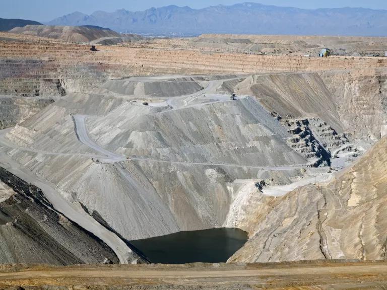
Meanwhile, both active and inactive mines dot the valley—558 in Santa Cruz County and 1,638 in Pima County. And as demand for copper and other critical minerals grows, the pressure to expand or approve new mining projects is ramping up.
So are the risks. Mines leach contaminants, like lead, into drinking wells, with some residents already finding “iron sludge” in their water. Others experience major drops in water tables due to a “cone of depression” formed by the industry’s water-intensive activities. Reducing Clean Water Act requirements applicable to freshwater, as envisioned by the PERMIT Act and the Trump administration’s proposed regulations, would only fast-track these thirsty and dirty projects. Companies would find less oversight restricting their operations, especially in areas where water moves through groundwater systems or ephemeral channels.
While some companies pledge to reduce tailings dust and minimize erosion, the results are mixed at best when industries are left to self-regulate. Basically, companies do well when complying with stricter environmental rules also benefits their bottom lines. But progress becomes uneven when meeting higher standards requires more significant investment in resources.
Even so, water quality in the river has improved in measurable ways. “We’re not seeing [mining runoff] pollution in this river system,” Cole says. While localized issues—such as E. coli contamination stemming from human and animal waste—persist, they are not currently the dominant threat.
The larger concern for the river system, Cole notes, is regulatory rollback. “Fortunately, [local authorities] have been establishing ordinances,” he adds, which goes a long way toward protecting the water. In Arizona, a patchwork of state and local water quality safeguards have helped buffer the Santa Cruz River from some of the more abrupt policy swings.
A model—and a warning
In less than 20 years, community partnerships have transformed a previously dry channel into an oasis for local wildlife and communities alike. Neighbors stroll a beloved river walk, birders flock to the lush banks of the Anza Trail, and populations of native fish have rebounded.
Downstream, the Santa Cruz joins up with the Gila and Colorado rivers, eventually flowing into the Gulf of California—a reminder that all waterways eventually connect and that even very local restoration efforts can benefit the larger whole.
The Santa Cruz’s recovery is real, but permanence is not guaranteed. Without sustained protection, investment, and coordination across agencies, borders, and communities, progress can quickly dry up.
This story was originally published on May 6, 2026, and was updated on September 4, 2026, with new information and links.
This NRDC.org story is available for online republication by news media outlets or nonprofits under these conditions: The writer(s) must be credited with a byline; you must note prominently that the story was originally published by NRDC.org and link to the original; the story cannot be edited (beyond simple things such as grammar); you can’t resell the story in any form or grant republishing rights to other outlets; you can’t republish our material wholesale or automatically—you need to select stories individually; you can’t republish the photos or graphics on our site without specific permission; you should drop us a note to let us know when you’ve used one of our stories.
Most of the nation's waterways may soon be without critical Clean Water Act protections
Before the Clean Water Act, sewage, oil, chemical wastes, and heavy metals were dumped into our rivers, streams, and wetlands. Don't let. the EPA bring those days back.
Reject the EPA’s plan to hand waterways to polluters!
The EPA has proposed a rule that would leave at least 94 percent of the nation's wetlands and 79 percent of its streams without critical Clean Water Act protections, jeopardizing clean drinking water for millions of Americans. Make your voice heard by October 9 to stop any attempts to gut clean water protections!
A Fund for Cleaning Up Coal Mining’s Toxic Legacy Dries Up
The Clean Water Act 101
The Attacks on Science Continue—This Time at the USGS